Mapping, Photography & GIS
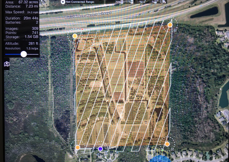
Equipped with state of the art cameras and GPS, our sUAVs allow for quick, efficient capture of aerial data. sUAVs can take significantly higher resolution images than current satellites or manned aircraft. Flight planning software is used to calculate the most efficient flight path for the desired area and calculate mission parameters. The pre-planned flight program is uploaded to our sUAV, which will then autonomously execute the flight and imaging. Our pilot has the ability to override the programmed flight path if required. The photographic data is then uploaded to mapping software that "stitches" the overlapping images into 2D or 3D maps. Files can be manipulated in popular CAD and GIS programs. Resolutions of 1" per pixel are possible, while consumer satellite images are generally 6-12 inches per pixel and can be several years old. Just check one of the popular satellite image websites, is that the right color car in your driveway? Have your trees grown larger than shown? Flight plans are saved and can be exactly repeated for map comparisons. Infrared imaging can provide information on crops or groves of trees.